 Flight planning for PACE-PAX and ARCSIX, flight flown, and lessons learned - Poster A53D-2107
Abstract
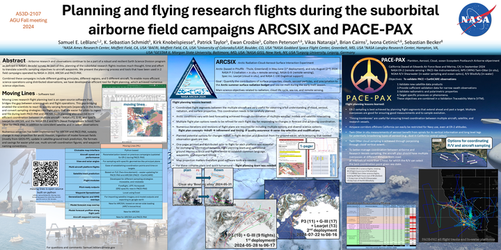
We show how we planned the measurements during the missions ARCSIX and PACE-PAX, measuring the arctic and the coastal California. Here we show what we flew and our planning strategy to optimize the observations and coordinate between the 3 different planes during ARCSIX; the NASA P3, G-III, and the Spec Inc. Learjet; and the 2 different planes with ships and satellites during PACE-PAX; the NASA ER-2 and the Naval Postgraduate School’s Twin Otter. The process of planning these flights is complex and involves mixing the needs from the science team and the needs from pilots, which we present here.
Date
Dec 13, 2024 13:00 — 17:30
Location
Washington, DC
Samuel LeBlanc
Research Scientist
Atmospheric Scientist studying colors of clouds and aerosol to better measure and understand climate